The project SEALEV is designed to understand past and present changes in the Greenland Ice Sheet (GrIS) and to project future rates of sea-level rise under climate change, for the Norwegian and other coastal regions. There is a strong focus on the processes in and over the ice sheet, and deliverance of freshwater to the ocean. With respect to regional sea-level rise, SEALEV has a strong observational basis, combining ocean density with remotely-sensed sea-surface height and gravity to assess the combined effect of mass exchange, steric changes and ocean dynamics on sea-level rise across the oceans. The geology work package quantifies past changes in sea level and ice sheets. A consistent system to improve sea-level projections in the 21st century is ensured by a strong core of modelling activity.
During 2013, SEALEV has been capitalizing on the efforts since the start of the project. Through the combination in situ hydrographical data, surface drifter data and direct current-meter measurements, together with coupled sea ice–ocean models, altimeter data and the latest GOCE-based geoid, knowledge of the circulation and sea level in the Nordic Seas and Arctic Ocean has been improved.
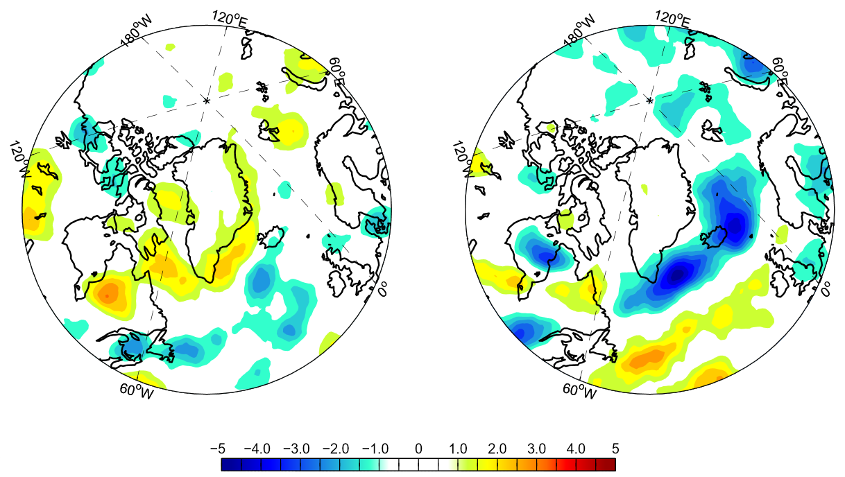
Constraining the surface elevation of the GrIS from combined satellite altimeter measurements has been improved greatly by multi-instrumental comparisons and assessment of uncertainties. It emerges that while the lower regions have been losing mass for many years, it is only in the latter years that the ice sheet has shown an overall sinking tendency. The studies of the atmospheric impact on the GrIS show that there are two main types of cyclone activity around Greenland, having both direct and indirect impacts on the accumulation and air temperature over the ice sheet (see figure).
High-resolution records of the retreat and calving rates of the Sermilik Fjord outlet glaciers since 1980 have revealed unexpectedly volatile advance-retreat behaviour of one of Greenland’s largest ice-sheet outlet glaciers, which underscores the complex nature of glacier variability and its interpretation as a response to climate change. The fjord-to-ocean modelling is on-going with a fine-scale coupled model setup with ocean, atmosphere, and ice shelf modules, showing in detail how Atlantic-derived waters penetrate Sermilik Fjord towards the outlet glaciers.
Published results from ice-sheet modelling based on CMIP5 models show that GrIS contribution to global sea-level rise may be as much as 13 cm by 2100 for the RCP8.5 emission scenario.
From the DATED database the time evolution of the Eurasian Ice Sheet through the past 25–10,000 years has been reconstructed, forming a unique basis for testing of both numerical ice-sheet modelling as well as GIA-modelling.
The earth system model NorESM has been further updated for sea level studies through, among other improvements, implementation of fresh water as mass (FWAM), and preparation of the NorESM ocean component for ice-shelf interaction.