Written by Jan Mangerud from the Bjerknes Center and the Department of Earth Science, University of Bergen.
Western Norway and Greenland looked almost identical for a long period some few thousand years ago when both areas first were covered by an ice sheet, and subsequently the ice margin started to retreat at the end of the Ice Age. But then their paths diverted; the retreat stopped and the ice sheet on Greenland remained, whereas in western Norway the retreat continued until the ice sheet had disappeared completely.
In a new article we describe ice flow directions based on measurements of almost 3000 glacial striae (scratches cut in the bedrock by glacial abrasion), and to our surprise the ice flow did not follow valleys and fjords when the ice was thick. For example on the almost 1000 m high summit of Gullfjellet, within the city borders of Bergen, the striae show ice flow due west. However, when the ice sheet became thinner it did not only follow the fjords, but in several fjords the margins calved back rapidly.
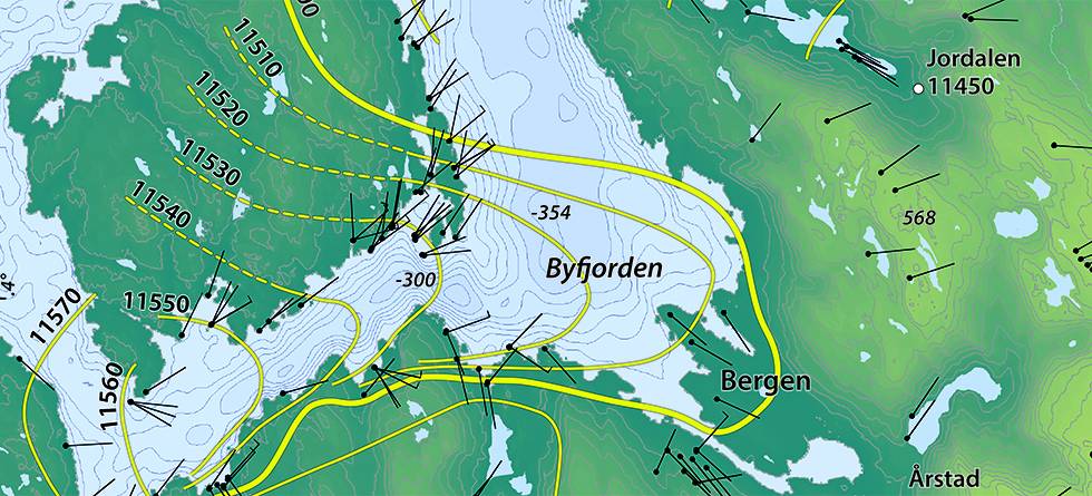
We have been able to date the ice-margin retreat with an almost decadal resolution by correlating dated sea levels with ice-margin deposits. On the map we show an example close to Bergen.
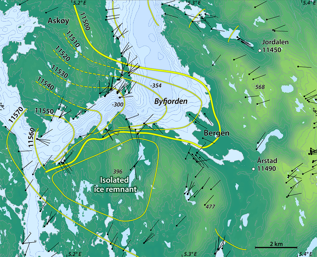
The yellow lines show the reconstructed ice margins marked with age in years before the present (BP) and the short black lines show the glacial striae. The oldest striae show ice flow along Byfjorden with a lobe spreading out in the western end, dated to 11,570 years BP.
Younger glacial striae have directions more towards the fjord, from a northerly direction on Askøy north of the fjord and from south into the fjord on the southern shore.
These directions show that between 11,560 and 11, 550 years BP there developed a calving bay in Byfjorden. This calving bay developed so fast until 11,500 and 11,490 years BP that the retreat on land and in shallower areas could not keep pace. The result was that a large body of ice was left isolated south of the fjord.
Ice is ice; it does not know any difference between Norway and Greenland. Understanding the deglaciation processes in western Norway may help understanding the future of Greenland in a warmer world.
The end of the Ice Age is the birth of Norway. After having been covered by ice for thousands of year the landscape opened for immigration of plants, animals and humans. Describing and understanding the climate and glacial development during the transition from the Last Ice Age to our warm postglacial period is crucial for understanding our present landscape.
Reference
Mangerud, J., Hughes, A.L.C., Sæle, T.H., Svendsen, J.I., 2019. Ice-flow patterns and precise timing of ice sheet retreat across a dissected fjord landscape in western Norway. Quaternary Science Reviews 214, 139-163